

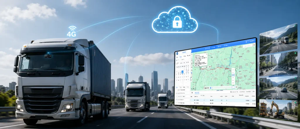
The infrastructure of fleet visibility management—dash cams without GPS can only tell you “what happened,” but a 4G dash cam with GPS can also tell you “where it happened, how the vehicle got there, and what the speed was at the time.” For accident liability, route management, fuel cost control, and customer service, the value of this location data is no lower than the video itself.
- The combined value of GPS + video is 1+1>2—location data gives video context, and video gives location data the truth. Only by combining them can the full scene be reconstructed
- Geofencing, route management, mileage tracking, parking analysis—these GPS-derived features can save fleets more money than the cost of the device itself
- GPS positioning accuracy matters, but what matters more is the “GPS + video linked experience”—click a trajectory point to see the corresponding video, that’s what truly works well
- Selection focuses on: positioning accuracy, trajectory completeness, geofencing capabilities, report richness, video-trajectory linkage experience—not just whether GPS is included
- Compliance is a hard threshold: location data is sensitive information. Data security, driver privacy, and GDPR compliance—all are non-negotiable
If you are evaluating a 4G GPS-enabled dash cam solution, we recommend reading GreatWill’s articles to clearly understand the real value of GPS features and selection points, then connect with suppliers for specific testing to avoid pitfalls.
Why GPS + Dash Cam Is More Powerful Than Either Alone
Many people think a dash cam just needs to record video, and GPS is an extra, optional feature. But anyone who has truly managed a fleet knows that video without location information loses much of its value.
The Limitations of Video Without Location Context
Let’s start with a very practical question: what does a dash cam without GPS lack?
Imagine this scenario: you receive a collision alert and pull up the video—yes, the vehicle did crash—but you don’t know where it crashed, what the speed was at the time, whether the driver was speeding, or what the road conditions were. You only have a piece of footage with no context.
Video without location information has several inherent shortcomings:
- Incomplete accident analysis: you can see the crash happened, but not where it occurred, what the speed was at the time, whether the driver was speeding, or whether it was on a hazardous stretch of road. Without this information, it is hard to perform root-cause analysis or take preventive measures
- Insufficient claim evidence: sometimes the accident location itself is key evidence—for example, whether the other party was changing lanes in a no-lane-change zone, or speeding in a speed-restricted zone. With GPS location and speed data, the evidence chain becomes more complete
- Route management is impossible: you don’t know what routes the vehicle actually took, whether there were detours, deviations from assigned routes, or visits to unauthorized places
- Inaccurate mileage statistics: without GPS, you cannot accurately count how many kilometers each vehicle runs per day, whether fuel consumption is correct, or when maintenance reminders should fire
- Crude driver behavior analysis: you only see counts of hard braking and hard acceleration, but not where these behaviors occurred—on the highway or in the city? Normal evasive maneuvers or genuinely dangerous driving?
According to Fleetistics research, fleets that install only dash cams without GPS have safety management efficiency more than 40% lower than those that install both—because you only have footage, no data, and cannot perform systematic analysis and improvement.
What GPS Data Adds to Video Evidence
So, what specific value does GPS data add to video?
With GPS, for every piece of video and every event, you will know:
- Precise location: latitude and longitude coordinates, accurate to a few meters. Exactly which intersection, which highway, and what position the accident occurred at—crystal clear
- Driving speed: what was the vehicle’s speed at the time? Was the driver speeding? By how much? This is critical for accident liability and driver management
- Driving direction: which way is the vehicle traveling? Was it going the wrong way? Did it take a wrong turn?
- Driving trajectory: how did the vehicle get there? Did it make sudden lane changes? Weaving? Trajectories can reveal many driving behavior issues
- Timestamp: precise time records synchronized with the video. What happened at what minute and second, aligned with the location
What happens when this information is overlaid on the video?
Here’s an example: a rear-end collision.
Video only: you see the car in front brake, and your car hits it. It looks like your fault—following too closely.
Video + GPS: you see the car in front brake, and at the same time GPS data shows—you were traveling at 60 km/h on a 80 km/h expressway, the car in front suddenly dropped from 50 km/h to 20 km/h on a main road where stopping is prohibited, and your braking distance was within the normal range. With this data laid out, the liability may be different—the car in front may be primarily at fault.
This is the value of GPS data—it makes video evidence more complete and more persuasive. For insurance claims and traffic police liability determination, video + GPS location + speed data forms a much stronger evidence chain.
The Synergy Effect: Safety + Visibility + Efficiency
The real power of GPS + dash cam lies in the “synergy effect”—the two features combined deliver value far greater than the sum of their individual contributions.
First level of synergy: safety management upgrade.
The dash cam handles “what happened,” and GPS handles “where and how it happened.” Only by combining them can you perform real safety management—not just reviewing video after the fact, but also analyzing accident hotspots, identifying high-risk routes, and targeting driver training and route optimization.
- For example, you find that a particular intersection has an unusually high number of accident alerts—that may not be the driver’s fault, the intersection itself may be poorly designed or have poor sight lines. You can adjust routes to avoid it
- For example, you find that hard braking happens unusually often on a certain highway stretch—it may be heavy traffic with frequent congestion. You can remind drivers to increase following distance on this stretch
- For example, you find that a particular driver tends to speed on a particular stretch of road—the road may have good conditions but a low speed limit. You can communicate with this driver specifically
Second level of synergy: operational efficiency improvement.
With GPS location and video, you gain full visibility into fleet operations:
- Dispatch: when a customer asks where the shipment is, you don’t need to call the driver. Just check the location and live video and answer within seconds
- Routes: did the driver follow the assigned route? Were there detours? Did they slack off? A pull of the trajectory reveals everything
- Parking: where is the vehicle parked? How long has it been there? Is it loading/unloading or resting? Is it at the designated location or somewhere off-limits?
- Mileage: how many kilometers does each vehicle run per day? Is fuel consumption reasonable? When is maintenance due? Automatically calculated, no manual work
Third level of synergy: cost reduction.
Safety improves, accidents drop, repair and insurance costs decrease, efficiency rises, management costs fall, customer satisfaction increases. The savings add up to far more than the equipment investment.
Here at GreatWill, having worked in in-vehicle video for many years, we have watched the industry evolve from “video only” to “video + GPS,” and now to the four-in-one “4G + GPS + AI + cloud platform” stack. This evolution is not vendor hype, it has been driven by real, dollar-and-cents demand from fleet managers—because the GPS + video combination genuinely solves problems and genuinely saves money.
Core Benefits of GPS-Enabled 4G Dash Cams
A GPS-enabled 4G dash cam offers much more than just “knowing where the vehicle is.” Combined with video and cloud platform, GPS data unlocks many practical functions, comprehensively covering safety, operations, and cost control.
Real-Time Fleet Visibility and Dispatch Efficiency
- Real-time fleet visibility, with dramatically improved dispatch efficiency.
In the past, once a fleet vehicle drove off, it was essentially “out of touch”—the driver said where they were, and that was that. Said they were almost there, and you took their word for it. Dispatch relied entirely on phone calls, which was unsafe because drivers had to pick up the phone while driving.
With GPS + 4G real-time video, the situation is completely different:
- Real-time location: open the platform and all vehicles’ positions are at a glance—which vehicle is where, what direction it’s heading, what speed—all visible at once
- Nearest-job dispatch: when a new task comes in, check which vehicle is closest and dispatch directly—no need to call each one to ask about location, saving time and fuel
- ETA estimation: when a customer asks when the vehicle will arrive, the system can automatically estimate the arrival time based on real-time location and route, far more accurate than calling the driver
- Abnormal stop alerts: if a vehicle stops for too long in an unauthorized location, the system automatically alerts—you can immediately pull up the video to check whether the vehicle has broken down or the driver is slacking
- Multi-vehicle coordination: when several vehicles run the same route, you can see who is ahead, who is behind, and the spacing between them, making dispatch coordination easy
According to Samsara’s 2025 report, fleets equipped with real-time GPS tracking and video monitoring see dispatch efficiency improve by more than 30%, customer response times shorten by 40%, and empty miles drop by 15%. These gains directly translate into cost savings—fewer wasted trips, fewer phone calls, and more satisfied customers.
Moreover, with dispatch efficiency improved, drivers also have less hassle—no more answering dispatch calls while driving, making it safer. Dispatchers no longer have to be glued to the phone, so their efficiency improves and each can manage more vehicles.
Accurate Mileage Tracking and Maintenance Scheduling
- Accurate mileage tracking and maintenance management.
In many fleets, mileage tracking relies on drivers filling out forms or reading odometers—both inaccurate and labor-intensive, and easy to fake.
GPS mileage tracking is different:
- Automatic counting: how many kilometers each vehicle runs per day, week, and month is automatically counted by the system—no manual entry, accurate and reliable
- Comparison with fueling data: by comparing mileage data against fueling data, real fuel consumption can be calculated—vehicles with abnormally high fuel consumption either have mechanical problems or fuel problems
- Maintenance reminders: automatically reminds you of maintenance based on mileage and notifies you when maintenance mileage is reached. No need to remember manually, no missed maintenance, no premature maintenance wasting money
- Personal use monitoring: company vehicle personal use or drivers running private side jobs can be detected from mileage and routes—the vehicle running around after hours or not in the designated location on weekends is easy to spot
- Report export: monthly, quarterly, and annual mileage reports can be exported with one click, making cost accounting and budgeting easy
The value of mileage data is more than just “knowing how much was driven”—it is the foundation of the entire fleet cost accounting—fuel, tolls, maintenance, and depreciation are all tied to mileage. If mileage data is inaccurate, the entire cost accounting is a muddled mess.
In real-world projects, comparing GPS mileage tracking with fueling data often reveals fuel consumption anomalies—either mechanical faults causing unusually high fuel consumption, or mileage falsification causing fuel card leakage. Plugging this loophole saves hundreds to thousands of dollars per vehicle per month on fuel, and the larger the fleet, the more substantial the savings.
Geofencing and Unauthorized Use Detection
- Geofencing and abnormal use detection.
What is geofencing? It means drawing a circle or an area on a map—such as a depot, a customer warehouse, or a restricted zone—and the system automatically alerts when a vehicle enters or leaves that area.
Geofencing may seem like a simple feature, but used well it solves many fleet management pain points:
- Depot in/out management: automatically logs when vehicles leave and return to the depot. No need for gate security to register, accurate and labor-saving
- Customer arrival alerts: when a vehicle arrives at the customer warehouse, the system automatically notifies dispatch and the customer—no need for drivers to call in, and customers can prepare loading/unloading in advance
- Restricted zone alerts: certain areas are off-limits (such as restricted-traffic zones, hazardous zones, competitors’ territories). The system alerts the moment a vehicle enters—preventing drivers from wandering into restricted zones and getting fined, and preventing commercial information leaks
- Off-hours/weekend abnormal movement: vehicles should be parked at the depot after hours and on holidays. If they move, the system automatically alerts—preventing personal use and theft
- Stay-time exceeded alerts: if a vehicle stays at a non-designated location longer than the set time, the system automatically alerts—is the driver slacking? Did they go somewhere they shouldn’t?
Geofencing is particularly valuable for fleet management—it turns “passive management” into “active management.” You don’t need to stare at the screen all day, the system watches for you and notifies you automatically of any anomalies. GreatWill wholesale GPS vehicle video equipment solutions come with geofencing as standard, supporting circular, polygonal, and many other fence shapes. Both entry and exit can be configured to trigger alerts, making it very flexible.
Route Optimization and Fuel Cost Reduction
- Route optimization and fuel savings.
Fuel is one of the largest fleet operating costs—typically 30%-40% of total operating costs. A little fuel saving means a little more profit.
How does GPS data help you save fuel? Several aspects:
- Route optimization: analyze drivers’ driving trajectories to identify unreasonable routes and detours, find the optimal routes, and roll them out across the fleet.
- Idle monitoring: when a vehicle idles, it burns fuel without working. Long idle times waste a lot of fuel. GPS can track how long each vehicle idles per day and how much fuel is wasted idling, enabling targeted management.
- Speed management: speeding is not just a safety issue—it also wastes fuel—beyond a certain speed, wind resistance increases sharply, and fuel consumption rises dramatically. Controlling speeding both improves safety and saves fuel.
- Hard acceleration and hard braking: aggressive driving also raises fuel consumption. Drivers with frequent hard acceleration and hard braking consume 15%-20% more fuel than smooth drivers. Identifying these behaviors with GPS + video and providing targeted training can lower fuel consumption
- Personal use of company vehicles: as mentioned earlier, personal use is not just a management issue but also a cost issue—the fuel burned and mileage run for personal use are paid by the company. With GPS in place, all of this can be saved
According to Verizon Connect data, fleets equipped with GPS tracking systems reduce average fuel consumption by 10%-15%. This number may sound modest, but multiplied by fleet size and annual mileage, it adds up to significant savings.
Here’s an example: a 50-vehicle fleet, each running 200 km per day, 250 days per year, has annual mileage of 2.5 million km. Assuming fuel cost of $0.8 per km, annual fuel cost is $2 million. A 10% reduction equals $200,000—enough to buy several sets of equipment.
Moreover, fuel savings are only the visible part. The invisible parts—fewer safety incidents, higher management efficiency, longer vehicle lifespan—add up to even greater value.
How GPS + Video Integration Works in Practice
Some solutions treat GPS and video as separate features—GPS does GPS and video does video. Others integrate them deeply, so clicking a trajectory point plays the corresponding video. The experience is totally different.
GPS Data Synchronization with Video Footage
GPS and video synchronization accuracy—how precisely the video frames align with the GPS data (location, speed, time). At the Nth second of video, the GPS data should correspond to the location at the Nth second, with minimal drift.
What happens when synchronization accuracy is poor?
- You see the vehicle crash in the video, but GPS shows it is still 50 meters away—the evidence doesn’t line up.
- When you play back the trajectory, click a point, and the video that comes up is not the footage from that location—the experience is terrible.
- Speed data doesn’t match the video—the vehicle is stopped in the video but GPS still shows it moving—such data has no reference value.
A good solution should have GPS and video synchronization within 1 second, ideally at the tens of milliseconds level. How is this achieved?
- Hardware-level synchronization: the GPS module and video encoder are in the same chip or system, with unified timestamps, giving high synchronization accuracy.
- Time calibration: the time is periodically calibrated via the 4G network to ensure the device time matches standard time and does not drift over time.
When selecting, how do you judge whether synchronization accuracy is good?
- Pick a fixed reference (such as a traffic light) and check whether the time the vehicle reaches the traffic light in the video matches the time it reaches it on the GPS trajectory.
- Check whether trajectory playback and video are synchronized on the platform—dragging the video progress bar moves the trajectory position. Clicking a point on the trajectory jumps the video to the corresponding time.
- Check whether the video and GPS data match in accident reports—at the time of impact, do the GPS speed changes align with the video footage?
GreatWill’s devices use hardware-level GPS-video synchronization, with accuracy within 100 milliseconds. Trajectory playback on the platform is fully synchronized with video: click a trajectory point to see the video, drag the video to see the position—very smooth. Many customers say this linked experience is the best they have used.
Interactive Map and Timeline Playback
Map and timeline interaction experience—with both GPS and video in place, how the data is presented to users makes a big difference. A good platform should be “a picture is worth a thousand words”—open the map and vehicle positions, trajectories, and event distributions are immediately clear.
Several core interaction experience points:
First, real-time map.
- All vehicles displayed in real time on the map with clear icons that show direction and status (driving/parked/offline).
- Supports grouping of vehicles—by fleet, by region, by status—so things don’t get messy with large numbers of vehicles
- Search function—enter a vehicle number or driver name to quickly locate a specific vehicle.
Second, trajectory playback
- Select a vehicle and a time period to play back that period’s trajectory—where it went, where it stopped, what speed—at a glance.
- Trajectory and video play back synchronously—on the left the map’s trajectory moves while the video plays synchronously on the right. You can immediately see what happened where.
- Supports variable-speed playback—fast forward, slow motion, drag the progress bar, watch however you like.
Fourth, timeline view.
- The timeline shows the day’s driving, parking, and event distribution—at a glance you can see how the vehicle ran that day, when it left, when it returned, how many stops it made, and which time points had events.
- Click anywhere on the timeline and the video and trajectory both jump to the corresponding time point, making operation intuitive.
A good platform can double management efficiency. A bad one—no matter how many features—no one wants to use it.
Event Reconstruction with Combined GPS + Video Data
Event reconstruction capability—one of the greatest values of GPS + video is event reconstruction—when an accident occurs or there is a dispute, can the full story be reconstructed completely and clearly?
What information should a good event reconstruction include?
- Event video: video clips before and after the event from multiple angles—front road, in-cabin, right blind spot, etc.
- Driving trajectory: the trajectory from some time before the event—where the vehicle came from, what route it took, where it changed lanes.
- Speed curve: the speed changes before and after the event—when the brakes were applied, how strong the deceleration, what speed at the moment of impact.
- Location map: the exact position of the event on the map—on which road, which lane, what location.
- Timeline: a complete event timeline—what happened how many seconds before, during, and after the event.
- AI analysis: DMS and ADAS alert records—what the driver’s state was, whether they were distracted or fatigued, whether the system issued warnings.
Integrating all this information together forms a complete “event report”—whether for insurance, traffic police, the customer, or internal analysis, what you present is a complete evidence chain.
In the past, many fleets had to manually pull video, search GPS data, and look through alert records to piece together accident handling—time-consuming and laborious. With a well-integrated platform, the system automatically generates event reports—one-click export, video + trajectory + speed + alerts, all included, ready to use.
According to our customers’ feedback, after adopting automatic event reports, the time to handle a single accident dropped from an average of 2-3 hours to 15-20 minutes—efficiency improved several times over. Reports are also more professional and complete, making claims and liability determination easier.
GreatWill’s platform comes with automatic event reports as standard. Every alert event automatically generates a complete report containing multi-angle video, driving trajectory, speed curve, location map, and AI analysis results. Heavy-truck GPS dash cam customers in particular use this heavily—because large-truck accident handling is more complex, complete event reports save them a lot of work.
Advanced GPS Features for Fleet Management
Basic positioning and trajectories are just the beginning. A mature GPS fleet management system offers many advanced features that let you manage your fleet more precisely and efficiently.
Geofencing Strategies for Different Fleet Types
Different types of fleets use geofencing in completely different ways.
- Warehouse/delivery truck fleets:
- Warehouse/delivery-point fences: set a fence around each warehouse and customer address. Vehicle arrival and departure are automatically logged, automatically calculating loading/unloading time. No need for drivers to report in, dispatch has full visibility.
- Route fences: set common routes as strip-shaped fences, vehicles deviating from the route are automatically alerted—preventing drivers from taking detours, running private jobs, or going the wrong way.
- Restricted-traffic zone fences: set restricted-traffic zones as prohibited areas, vehicles entering are automatically alerted—avoiding fines.
Engineering fleets:
- Site fences: set a fence around each construction site. Vehicle entry and exit are automatically logged with hours—for accounting shift fees and workload statistics.
- Spoil dump fences: set fences at designated dump sites, dumping at non-designated locations triggers automatic alerts—preventing illegal dumping and the theft/sale of building materials.
- Restricted-traffic zone fences: city roads, residential areas, school zones, and other restricted-traffic zones are set as prohibited areas, preventing public disturbance and violations.
Passenger/shuttle fleets:
- Stop fences: set a fence around each stop. Vehicle arrival and departure times are automatically logged—for assessing on-time performance.
- Route fences: set fences on fixed routes, deviations from the route trigger automatic alerts—preventing drivers from changing routes or skipping stops.
- Parking lot fences: vehicles should be parked at the designated parking lot after shift. Vehicles not at the parking lot trigger automatic alerts—preventing personal use.
Hazardous-materials transport fleets:
- Restricted-zone fences: densely populated areas, schools, hospitals, water sources, and other sensitive areas are set as prohibited zones, vehicles entering trigger immediate alerts—a compliance red line.
- Designated-route fences: hazardous-materials transport must follow designated routes. Deviations trigger alerts—regulatory requirement.
- Parking fences: parking and rest must occur at designated safe areas, random parking is prohibited—safety requirement.
You see, geofencing usage varies widely across fleet types. When selecting, check whether the platform’s geofencing capabilities are flexible enough—how many shapes are supported? How many fences can be set? How many alert methods? Can fences be set per vehicle group? These determine whether you can actually put the feature to use.
GreatWill’s platform offers highly flexible geofencing—supports circular, polygonal, line-shaped, and strip-shaped fences, supports entry/exit/dwell trigger modes, supports per-group fence assignment, and offers alert methods including platform notifications, SMS, and email. Every type of fleet can find a configuration that fits.
Driver Behavior Scoring Using GPS + Video Data
Driver behavior scoring uses GPS and video data to assign each driver a safety score, making driver management data-driven and visualized.
Driver behavior is about configuring various safety-impacting driving behaviors as alert conditions, providing reminders and regulating behavior:
- Speeding: number of speeding events, total duration, and severity.
- Hard braking: count and intensity of emergency braking—frequent hard braking indicates following too closely or poor anticipation.
- Hard acceleration: count of aggressive throttle use—aggressive driving is unsafe and wastes fuel.
- Sharp turns: rapid lane changes and sharp turns—poor driving habits that easily lead to rollovers and loss of control.
- Fatigue driving: number and duration of fatigue events detected by DMS—fatigue is a major accident cause.
- Distracted driving: phone calls, phone checking, looking around—distracted driving has a very high accident rate.
- Not wearing seatbelt: count of times seatbelt is not worn—poor safety awareness.
- Night driving: duration and ratio of night driving—night-time accident risk is higher.
According to Samsara data, fleets that implement driver safety scoring systems see accident rates drop 25%-35% and overall driver behavior improve significantly. Because drivers have clear scoring criteria, they know what is good, what is bad, and where they fall short—with goals and direction, improvement comes quickly.
Reporting and Analytics: Turning Data into Action
Reports and analytics—turn the large volumes of data generated by GPS and video into valuable insights and action recommendations.
A fleet management platform should turn data into intuitive reports and charts, allowing managers to see at a glance where problems lie, what the trends are, and in which direction to improve.
Common report types:
- Safety reports: overall fleet safety trends, each driver’s safety score, accident and alert statistics, high-incident-segment analysis—for safety management decisions.
- Operations reports: mileage statistics, fuel consumption analysis, utilization, empty-mile ratio, on-time rate—for operational efficiency analysis.
- Driver reports: each driver’s driving behavior statistics, safety score ranking, alert type distribution—for driver management and training.
- Vehicle reports: each vehicle’s mileage, idle time, fuel consumption estimate, maintenance reminders—for vehicle management and maintenance.
- Compliance reports: driving duration, rest time, speeding records, violation records—for compliance management and regulatory reporting.
GPS Accuracy, Reliability, and Technical Considerations
Whether GPS features are useful depends fundamentally on whether positioning is accurate and stable. If positioning drifts around or frequently loses signal, no amount of features will help.
Understanding GPS Accuracy for Fleet Use
What is the actual GPS positioning accuracy? Why are some devices accurate and others not?
GPS positioning accuracy is affected by many factors:
- Satellite signal: how many satellites are visible? Signal strength? In open areas 10+ satellites can be seen and positioning is accurate, between urban high-rises only 4-5 may be visible and accuracy drops.
- Multipath effects: signals reflect off high-rises and hills, causing errors and position offset. Most obvious in urban canyons.
- Antenna quality: the GPS antenna quality directly affects signal reception. A good antenna has strong signal and interference rejection, a poor antenna has weak signal and easily loses satellites.
- Chipset performance: the GPS chipset algorithm also affects positioning accuracy. A good chipset maintains positioning under weak signals, a poor chipset loses fix as soon as it enters a tunnel.
- Assisted positioning: is assisted positioning available (such as base-station assisted positioning, AGPS)? When GPS signal is poor, other methods can help and reduce blind spots.
Higher accuracy isn’t always better—higher-accuracy devices cost more. Choose what meets your actual needs. GreatWill devices use high-performance GPS chipsets and high-gain antennas, with fast positioning and stable signals, maintaining good accuracy in most scenarios. They also support multiple satellite systems (GPS + BeiDou + GLONASS), receiving signals from multiple satellite systems simultaneously for more accurate and stable positioning—particularly advantageous in urban canyons and obstructed environments.
Battery and Power ConsiderationsPower and endurance. This relates to parking monitoring functionality and vehicle battery safety.
The power design of GPS-enabled 4G dash cams is more complex than that of regular dash cams—because regular dash cams power off when the vehicle is off, but GPS tracking may need to keep working after the ignition is off, such as for parking monitoring, shock alerts, and anti-theft tracking.
There are several common power options:
Option 1: Constant power supply from the vehicle + low-voltage protection.
- Powered directly from the vehicle battery, 24-hour supply. After ignition off, the device continues to operate (usually entering a low-power mode)
- Low-voltage protection automatically shuts down the device when battery voltage drops below the set threshold, preventing battery drain that prevents engine start
- Pros: no extra battery needed, stable power supply, no battery life concerns
- Cons: if the vehicle is parked for a long time (e.g., one or two weeks without driving), the battery may drain, installation requires finding a constant-power wire, more complicated than connecting to the cigarette lighter
Option 2: Built-in battery.
- The device has a small internal battery that keeps it running for a while after ignition off
- Pros: simple installation, no impact on the vehicle’s electrical circuit
- Cons: limited battery capacity, short working time after parking, large temperature variations in the vehicle environment shorten battery life, requiring battery replacement after a few years
Option 3: External backup battery.
- An external large-capacity backup battery pack powers the device after ignition off
- Pros: long endurance, can support parking monitoring for days or even weeks
- Cons: high cost, complicated installation, takes up space, and the battery also has lifespan issues
GreatWill devices support constant-power supply + smart low-voltage protection. The low-voltage protection threshold and the post-parking delayed shutdown time can both be set via the app. GreatWill 4G fleet dash cam custom solutions can recommend the most suitable power configuration and parameter settings based on the customer’s vehicle type and usage scenario, ensuring that functional requirements are met without affecting normal vehicle starting.
How to Choose the Best GPS Dash Cam for Your Fleet
There are many GPS-enabled dash cams on the market, ranging from tens of dollars for consumer-grade to thousands of dollars for enterprise-grade. How do you choose? Look at specs? Look at the brand? Or look at the price?
Key GPS Features for Fleet Operations
For GPS features themselves, what should you look at when selecting?
First, positioning capability.
- Which satellite systems are supported? GPS, BeiDou, GLONASS, Galileo—the more systems supported, the more satellites received, and the faster and more accurate the positioning
- What is the approximate positioning accuracy? How does it perform in different scenarios such as open areas, cities, and tunnels?
- Cold start / hot start time? How long after power-on until positioning is acquired? This affects user experience
- Is there DR (dead reckoning)? How does it perform in tunnels and urban canyons?
Second, trajectory and playback.
- What is the trajectory recording frequency? 1 point per second or 1 per 5 seconds? Higher frequency means more detailed trajectories, but also more data
- How long can historical trajectories be stored? How long in the cloud? How long locally?
- How good is the trajectory playback experience? Is it synchronized with video? Variable speed supported? Event annotation supported?
Third, geofencing.
- Which fence shapes are supported? Circular, polygonal, line-shaped, strip-shaped?
- What is the maximum number of fences that can be set? Is it enough?
- Which trigger modes are supported? Entry, exit, dwell-time exceeded?
- What alert methods are available? Platform notifications, SMS, email, voice broadcast?
Fourth, reports and analytics.
- What preset reports are available? Do they cover safety, operations, drivers, and vehicles?
- Can reports be customized? Can they be exported? In what formats?
- Is there a driver scoring system? Can the scoring dimensions be adjusted?
- Can data be exported via API? Can it interface with your own systems?
You may not need every feature, but you should determine which are must-haves and which are nice-to-haves based on your fleet management requirements. Don’t pay extra for features you won’t use, and don’t save money by cutting essential features.
Integrated vs. Separate Systems: Pros and Cons
For GPS features themselves, what should you look at when selecting?
First, positioning capability.
- Which satellite systems are supported? GPS, BeiDou, GLONASS, Galileo—the more systems supported, the more satellites received, and the faster and more accurate the positioning
- What is the approximate positioning accuracy? How does it perform in different scenarios such as open areas, cities, and tunnels?
- Cold start / hot start time? How long after power-on until positioning is acquired? This affects user experience
- Is there DR (dead reckoning)? How does it perform in tunnels and urban canyons?
Second, trajectory and playback.
- What is the trajectory recording frequency? 1 point per second or 1 per 5 seconds? Higher frequency means more detailed trajectories, but also more data
- How long can historical trajectories be stored? How long in the cloud? How long locally?
- How good is the trajectory playback experience? Is it synchronized with video? Variable speed supported? Event annotation supported?
Third, geofencing.
- Which fence shapes are supported? Circular, polygonal, line-shaped, strip-shaped?
- What is the maximum number of fences that can be set? Is it enough?
- Which trigger modes are supported? Entry, exit, dwell-time exceeded?
- What alert methods are available? Platform notifications, SMS, email, voice broadcast?
Fourth, reports and analytics.
- What preset reports are available? Do they cover safety, operations, drivers, and vehicles?
- Can reports be customized? Can they be exported? In what formats?
- Is there a driver scoring system? Can the scoring dimensions be adjusted?
- Can data be exported via API? Can it interface with your own systems?
You may not need every feature, but you should determine which are must-haves and which are nice-to-haves based on your fleet management requirements. Don’t pay extra for features you won’t use, and don’t save money by cutting essential features.
Questions to Ask Before You Buy
About features:
- Which satellite systems does the GPS support? What is the positioning accuracy?
- What is the trajectory recording frequency? How long is historical trajectory stored in the cloud?
- Which fence shapes and trigger modes does geofencing support? What is the maximum number of fences?
- What reports are available? Are custom reports supported? Can they be exported to Excel/PDF?
About the platform:
- Is the platform web-based or client-based? Is there a mobile app? Is the app fully featured?
- What is the maximum number of vehicles that can be online simultaneously? Will it lag with many vehicles?
- What is the platform’s SLA? Is the availability commitment 99.9% or higher?
- Does it support multiple languages? Which languages?
About security and compliance:
- Where is the data stored? In which country? Can the storage region be specified?
- What is the data encryption standard? Are both transmission and storage encrypted?
- How granular is the permission management? Are audit logs available?
- Who owns the data? Can it be exported at any time? In what format?
- Does it offer GDPR compliance capabilities?
About cost:
- How much per device? Is there a minimum order quantity? Are there volume discounts?
- How is the platform fee charged? Per device or per user? How much per device/month? Are there annual payment discounts?
- Is data included? Or is it charged extra? How are overages calculated?
- Are AI features included or charged extra? How are they priced?
About service:
- How long is the warranty? How are failures handled during the warranty period? Replacement or repair? How long does it take?
- How is technical support provided? What is the response time?
- Is Chinese/English support available? What are the service hours? Is 24/7 support available?
- Are future feature upgrades extra, or does the subscription include all updates?
As GreatWill, a professional vehicle GPS positioning dash cam wholesale manufacturer, we welcome your inquiries.
Frequently Asked Questions
GPS positioning in legitimate enterprise-grade devices generally achieves 3-5 meter accuracy in open areas and 5-15 meters on city roads—sufficient for fleet management needs. Dense urban high-rise areas (urban canyons) will indeed have some drift, which is determined by the physical nature of GPS and applies to all devices—however, good devices can use multi-satellite systems, dead reckoning, and map matching to reduce drift and maintain trajectory continuity. We recommend requesting a sample for real-world testing before purchase—run it on your fleet’s regular routes for a few days to see the actual positioning performance, then decide. Spec sheets alone are not useful, actual real-world performance is what counts. GPS itself does not consume data—GPS is one-way reception of satellite signals, consuming no data. What consumes data is the process of uploading location data to the cloud. But location data volume is very small—about one point per second, each point only tens of bytes, so a day’s worth is only a few MB—negligible compared to video upload data. What actually consumes data is video uploads (event video, live streaming), not GPS data. So you don’t need to worry about the data cost of GPS features, compared to video data, it is a small fraction. This depends on the device’s power settings. Legitimate commercial devices offer several modes: 1) ACC ignition-on mode: the device powers off when the ignition is off, no power consumption—completely no battery drain concerns, 2) Constant power + delayed shutdown: the device continues to work for some time (e.g., 30 minutes) after ignition off, then automatically shuts down, 3) Constant power + low-power mode: the device enters low-power standby after ignition off, waking up only on collision or vibration, with very low power consumption in normal times, 4) Constant power + low-voltage protection: always working, but automatically shuts down when battery voltage drops below the set threshold to ensure the vehicle can start. Which mode is appropriate depends on your needs—if you only need recording while driving, ACC mode is the easiest, if you need parking monitoring, use low-voltage protection mode with a reasonable threshold to avoid battery drain. We recommend confirming the power setup and low-voltage protection settings with the supplier before installation. This depends on the solution you choose. With an integrated 4G dash cam (with built-in GPS), GPS data and video are on the same platform and deeply integrated—trajectory and video play back synchronously, click an event to see video, automatic event report generation—great experience. If you have a separate GPS tracker and dash cam as two independent systems, you need to view them on two platforms separately with no data linkage, leading to a much worse experience. So, if you need both video and GPS, we strongly recommend an integrated solution—much higher management efficiency and lower cost. This is a problem many fleets face. The key is communication and positioning. First, position GPS as a “safety management tool” and a “dispatching tool,” not a “surveillance tool”—emphasize that it can prove the driver is not at fault in an accident, reduce unnecessary dispatch calls, and optimize routes to save the driver time. These are benefits to drivers, not surveillance of them. Second, establish transparent usage policies: who can view the data, under what circumstances, for how long, how long is data retained, automatic deletion upon expiry—write it down clearly and publish to all. Third, set privacy boundaries: during rest time and after parking, GPS can reduce frequency or stop positioning, and in-cabin cameras can enter privacy mode. Fourth, let drivers benefit: drivers with high safety scores get rewards, fuel savings earn bonuses—make drivers feel the system is helping them, not managing them. Make the rules clear, draw the boundaries clearly, and explain the benefits. Most drivers will understand and accept it.
How accurate is the GPS positioning in dash cams? Will it drift in cities?
Does GPS consume a lot of data? Roughly how much per month?
Does GPS continue to work after the vehicle is parked? Will it drain the battery?
Can GPS data and video be viewed on the same platform, or do they need to be viewed separately?
The driver refuses GPS installation, citing privacy concerns. What should we do?
GreatWill has its own production factory, having been in the vehicle video equipment industry for 19+ years, from the earliest single-channel SD card recorders to today’s multi-channel 4G + AI + cloud platform solutions, going through several generations of technological iteration. Our dual-channel, three-channel, four-channel, and five-channel products have all been validated through large numbers of fleet projects, with reliability, stability, and practicality proven by real-world scenarios.
Our customers include inter-city logistics, urban distribution, engineering transportation, hazardous-materials transportation, and overseas brand OEM fleets—every vehicle type, scenario, and fleet scale. Different fleets have different pain points, and our solutions differ accordingly—we don’t force a standard product on you but recommend the most suitable configuration based on your actual situation.If you are evaluating a 4G GPS-enabled dash cam solution, you can contact our team to discuss the following:
- What GPS configuration and feature combination suits your fleet scenario
- Specific configuration plan and cost budget (equipment + installation + platform + data)
- Sample testing and pilot collaboration plan
- Platform integration and customization needs
We can provide a tailored solution recommendation and quote based on your fleet’s actual operational scenario and management needs.
Related Articles
If you are interested in GPS-enabled 4G dash cams and fleet safety management, the following articles may be helpful:
4G Dash Cam Fleet Management: A Complete Solution Guide
How 4G Dash Cams Reduce Fleet Operating Costs: ROI Analysis
Multi-Channel 4G Dash Cams: Why Fleets Need Multi-Camera Systems


Responses
Discussion
0 responses
No responses yet
Start the discussion with a practical question or field note related to this article.